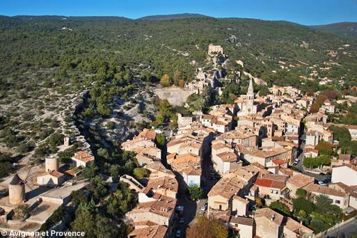
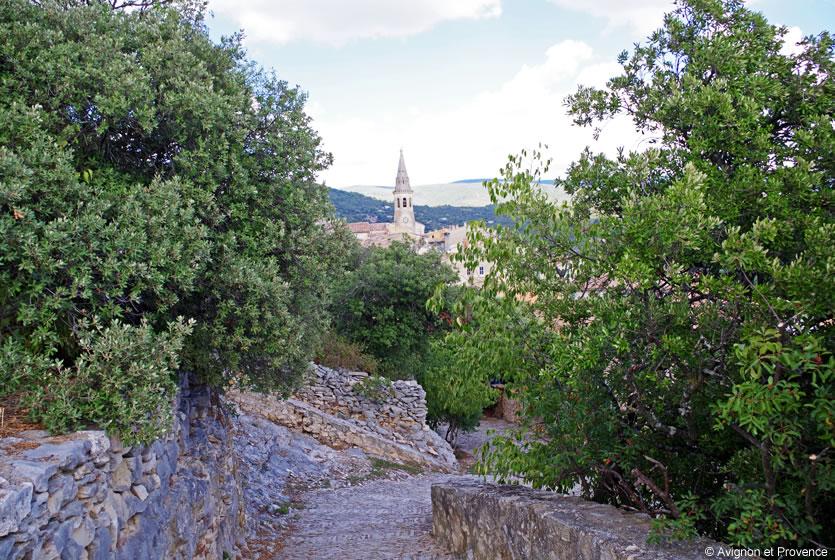
This medieval village, situated on the southern slope of the Monts de Vaucluse at 400 metres altitude, is part of the Regional Nature Park of the Luberon. Its surface area makes it the third biggest town in the Vaucluse. Built on a rocky outcrop, it offers exceptional panoramic views over the Luberon, the Alpilles and the Monts de Vaucluse. All around, a landscape of scrubland and forests lies at your feet.
In spring, a sea of pink and white flowers encircles this village clinging to the hill. Cherry orchards, olive trees and vineyards (AOC Ventoux) share the land. And if you go to the weekly market on Tuesday morning, you can sample all the local produce.
Starting in the centre of the town and throughout your visit, you can admire the fountains, the balcony supported by “Atlantes”, the washhouses, the Saint-Etienne parish church, the two 17th century windmills and the splendid doors, which rival those of the most bourgeois private mansions in Aix (3 are listed as Historic Monuments).
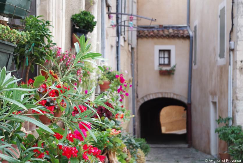
Walk in the streets of the village of Saint-Saturnin lès Apt
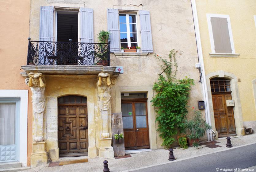
Maison des Maison des Atlantes in Saint Saturnin les Apt
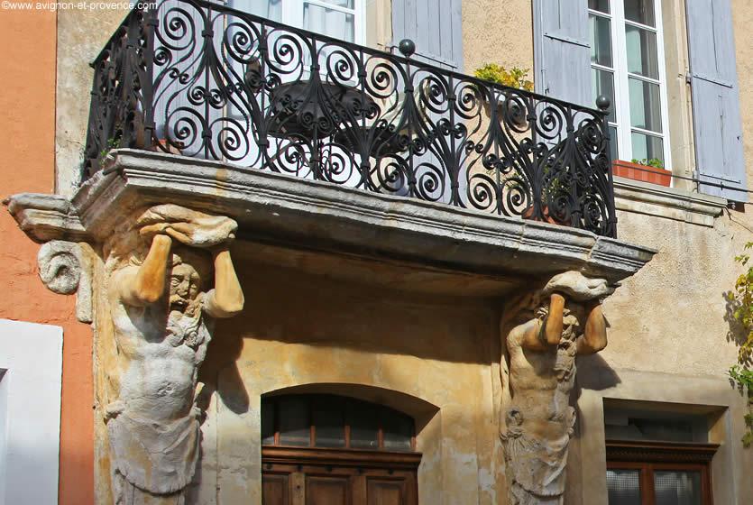
The Atlantes balcony in Saint-Saturnin-les-Apt
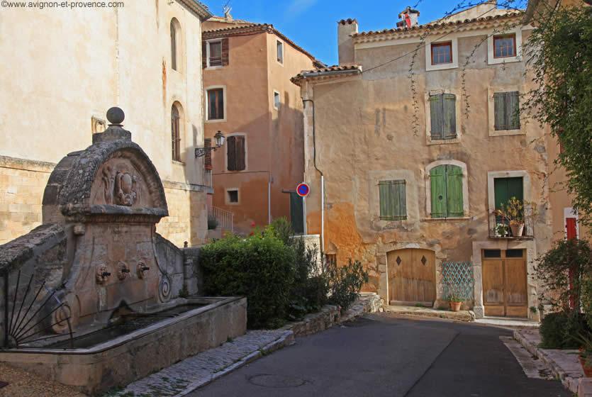
Village fountain
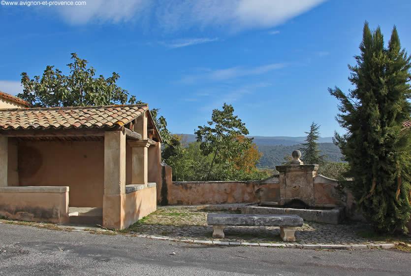
The washhouse in Saint-Saturnin
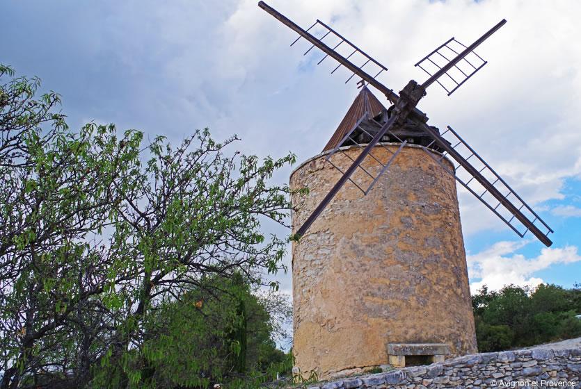
Windmill in Saint Saturnin les Apt
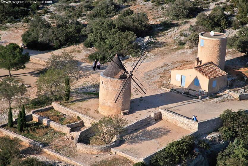
The 17th century windmills, Saint-Saturnin-les-Apt
View of Saint Saturnin les Apt
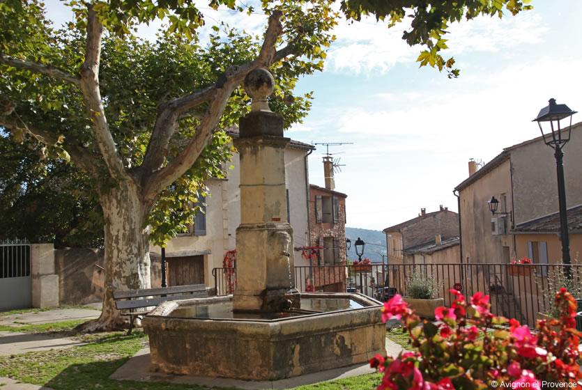
Fountain in the village
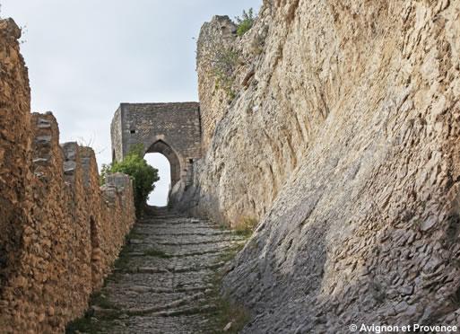
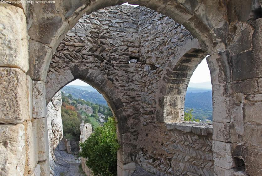
Going up to the château along the cobblestone streets, you discover the ruins of the primitive village surrounded by ramparts, the keep and castle chapel (1056) and the dam built in 1863 to guarantee a supply of fresh water for the population. Fishing is allowed there but it is advisable to ask at the Town Hall as rules limit the fishing periods.
The panoramic view over the plain is exceptional, covering the Monts de Vaucluse, the Colorado Provençal, the Grand and the Petit Luberon, the Alpilles...
Another specificity of Saint Saturnin-les-Apt is the many hiking trails. One of the most beautiful is the Aiguiers trail (in Provençal “aigo” means water). Leading between plains and mountains in the direction of Sault, it takes you past cisterns carved in the rock (used for catching rainwater) and about thirty hamlets. You will really enjoy this excursion starting in April, when the flowers start blooming, through to the autumn months with their brilliant earthy colours.
The history to see
The Chapel of the Château, the keep and the lord's chapel (1056)
Saint Pierre d’Agnane Priory (13th cent.)
Chapel of the Penitents (17th century ruins)
Saint Roch Chapel (built following the plague of 1720)
Saint Madeleine Chapel (to the north of Croagnes)
Saint Maurin Chapel (former Templar house of Saint Maurice)
Saint Radegonde Chapel (Péréal)
Chapel de l’Hôpital (retirement home)
The windmills (17th cent.)
Château de Bourgane
Ayguier Gate and ramparts
The Bories (approx. 130)
The Ayguiers (approx. 90)
Washhouses and fountains
The doors of the village (18th century, listed as historic monuments)
Croix de la Lave Cross
Sepulchral cave
Oppidum of Péréal
Citerne de l’Hôpital
Roman graves on the Sylla plain
Going up to the Château

Saint-Etienne Church

The village's reservoir
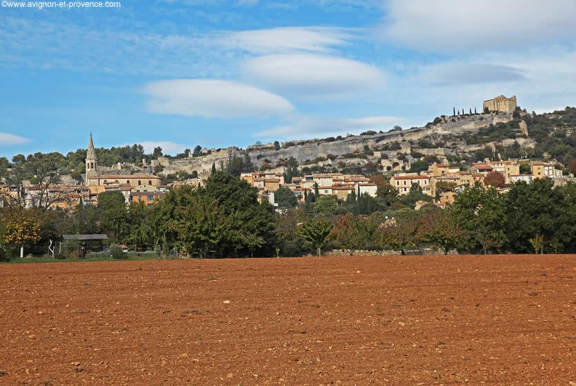
View of the village
Art of living
Gastronomy, markets of Provence, regional products, Christmas traditions, celebrities of Provence....